
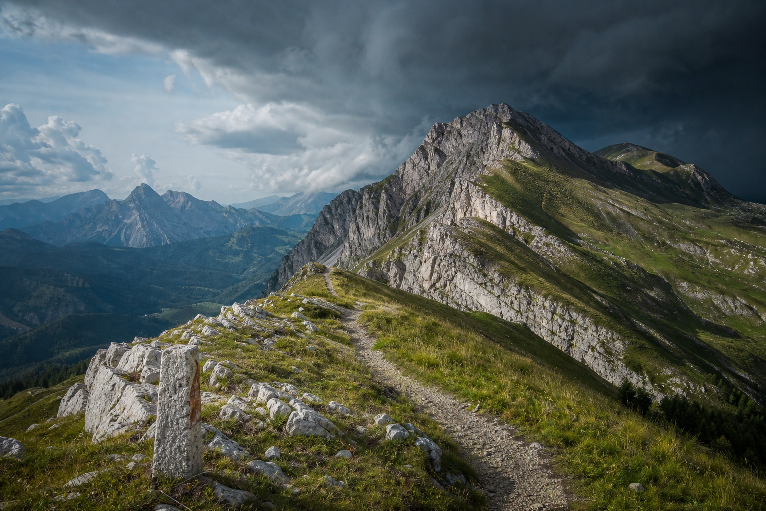
Weather trend for mountain tours in the Eastern Alps
Sunny Saturday, then thunderstorms threaten: This is what the mountain weather will be like in the Eastern Alps
The weekend in the Eastern Alps starts off relatively calm. Already on Sunday, the tendency for showers and thunderstorms increases significantly during the day. On the night to Monday, a cold front brings the next significant change in weather – with cooling, occasionally strong thunderstorms, and partly freshening westerly winds.
The following assessment is based on the mountain weather forecasts from GeoSphere Austria (Regional Office Innsbruck; updates from 29.05.2026, by time of day in the afternoon or at noon) as well as selected station measurements that underline the wet character of the more unstable phases.
Saturday (30.05.): most stable day in the period
Saturday is expected to have the calmest mountain weather of the days considered: high cloud fields, but still mostly sunny. The forecast predicts no precipitation in all four time windows (0 mm, 0 hours of precipitation duration), the risk remains consistently low.
The altitude values also indicate reliable conditions: At 1500 meters, temperatures range between 14 and 18 degrees depending on the time window, at 2500 meters between 7 and 9 degrees. The freezing level is around 3200 to 3300 meters, the frost line at 3600 to 3700 meters. The wind at 2500 meters remains mostly weak to moderate (10 to 20 km/h), with gusts around 20 to 30 km/h.
For tour planning, this means: Those planning longer activities will find the largest, most predictable weather window on Saturday – with no forecast precipitation and low risk signals.
Sunday (31.05.): still chances in the morning, significantly more critical in the afternoon
On Sunday, the situation becomes much more changeable. The forecast is clear in its tendency: showers in the morning, thunderstorm risk in the afternoon. In the first three time windows, the risk is still indicated as low, in the last time window it rises to very high – a typical pattern for convective situations, in which showers and thunderstorms can quickly organize, especially in the afternoon.
Temperature-wise, it remains mild at first: At 1500 meters, 13 to 17 degrees are expected, at 2500 meters 7 to 9 degrees. Precipitation is set at 0 to 5 mm or 1 to 5 mm depending on the time window. At the same time, the freezing level drops during the day from about 3300 to 3000 meters, before later returning to around 3100 meters. The wind at 2500 meters remains moderate at 10 to 20 km/h, gusts are around 30 km/h – the decisive deterioration comes less from the wind, but from the significantly increasing thunderstorm tendency.
- Benediktenwand: 15 mm in 10 hours
- Birkkarspitze: 15.5 mm in 9 hours
- Oberammergau: 14.7 mm in 9 hours
- Parseierspitze: 14.3 mm in 9 hours
In practice, this means: Start early, consistently plan time buffers, and complete summit and ridge passages preferably before the afternoon.
Monday (01.06.): Cold front at night – afterwards cooler, prone to showers, partly thundery
For Monday, a significant change in weather is described: At night, a cold front moves over the Eastern Alps, accompanied by occasionally strong thunderstorms. In the morning and into the late morning, rain showers are expected in many places, with thunderstorms also in the south and southeast. In the afternoon, it remains slightly unsettled, with further thunderstorms on the southern edge of the Alps and the last, subsiding showers along the northern Alps.
With the front, it becomes noticeably cooler: At 1500 meters, the range is from 10 to 19 degrees, at 2000 meters from 7 to 13 degrees, and at 3000 meters from 1 to 6 degrees. The freezing level is between 2800 and 3600 meters. In addition, there is occasionally freshening westerly wind, at 2000 meters with average values up to 40 km/h (at 3000 meters up to 30 km/h). The thunderstorm risk is given as 20 to 70 percent – a wide corridor, which in practice means: locally, it can quickly become much more uncomfortable, even if not every area is equally affected.
Behind the front, temporary clearings are possible in the north of South and East Tyrol with a slight north foehn. Overall, however, the situation remains changeable enough that tours with high exposure (long ridges, via ferratas, wide summit plateaus) on Monday are only sensible with very defensive planning.
From Tuesday (02.06.): in the west quickly prone to showers and thunderstorms again
For Tuesday, the next disturbance is already looming: After a mostly dry night, the day begins with extensive high clouds still partly sunny, while it can already be significantly cloudier in the far west and southwest. In a slightly foehn-like southwesterly flow, dense cumulus clouds are expected to form quickly there – with the first showers already in the morning. In the afternoon, heavy rain and embedded thunderstorms are expected in the west; in the eastern half, the mountain weather is initially more favorable, but later uncertain, depending on how far the thunderstorms spread from the west.
The temperature forecast for Tuesday is up to 16 degrees at 1500 meters, 9 to 14 degrees at 2000 meters, and about 5 degrees at 3000 meters; the freezing level is between 3300 and 3700 meters. The wind blows moderately to briskly from the southwest – a constellation that in the Alps is often associated with rapid cloud formation and local heavy precipitation.
- Benediktenwand: 24 mm in 6 hours
- Birkkarspitze: 27.9 mm in 6 hours
- Parseierspitze: 30.5 mm in 4 hours
Conclusion for tour planning
On Saturday, the most reliable mountain weather window is available in the Eastern Alps. On Sunday, the risk increases significantly, especially in the afternoon. On the night to Monday, a cold front brings the next change with thunderstorms, cooling, and air prone to showers. From Tuesday, instability in the west is expected to increase again.
Those who are out and about should consistently factor in the time of day as a safety factor: In thunderstorm situations, it is often not the average amount of precipitation that is decisive, but the timing – early turning back, alternative routes, and avoiding exposed areas are then the most important part of the strategy.