
Kempten (Allgäu)
Unnamed Road, 87437 Kempten (Allgäu), Deutschland
Illersteg | New Construction & Closure
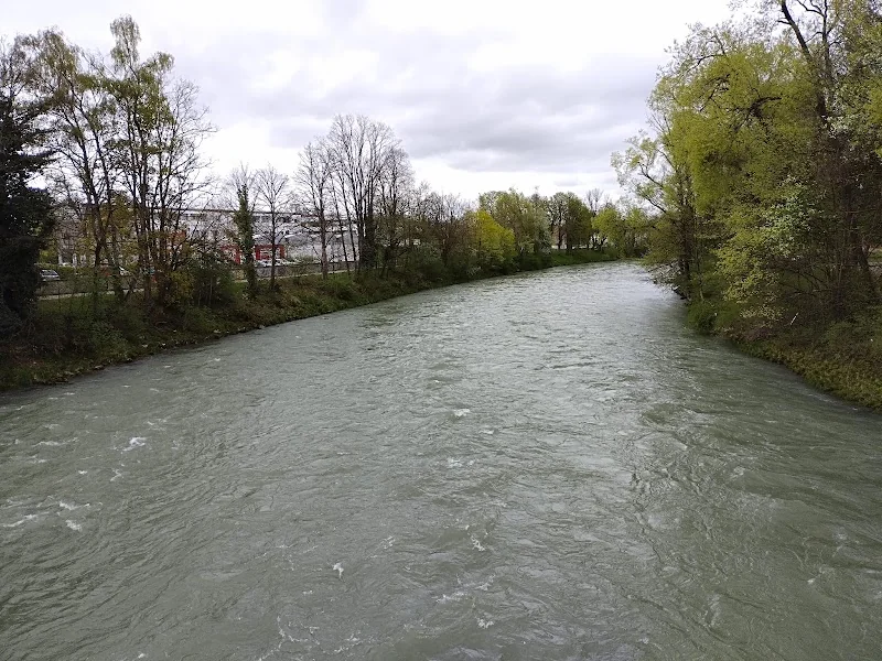
The Illersteg in Kempten (Allgäu) is much more than a simple crossing over the Iller. For many people, it is the direct connection between the city center, Illerdamm, the area near the Illerstadion, and the residential neighborhoods located east of the Iller. The city describes it as a main axis for pedestrian and bicycle traffic; at the same time, it provides access to the parking lots at Illerdamm and alleviates the route through the city center. This is precisely why the planned replacement construction is attracting so much attention: The structure has aged, the bridge is regularly inspected, and is now to be replaced by a new connection. For users, this means that the Illersteg remains a central topic for access, parking, closure, and detour in Kempten, shaping the daily journey into the city as well as excursions to the Iller. ([ratsinfo.kempten.de](https://ratsinfo.kempten.de/bi/getfile.php?id=84822&type=do&utm_source=openai))
Why the Illersteg is so important for Kempten
When analyzing search queries related to the Illersteg, a pattern becomes particularly clear: People want not only to find the name of the bridge but, above all, to understand how important this connection is in daily life. According to the city, the Illersteg connects the city center with 379 parking spaces at Illerdamm and with the residential area east of the Iller; it is also an important east-west axis for cyclists. The strong usage of this connection is also evidenced by the counting data from 2023: The bridge was crossed approximately 1.25 million times, of which 870,000 times on foot. These figures explain why the term Illersteg is not only searched as a place name in Kempten but is almost always associated with the topics of new construction, closure, parking, and detour. For the locals, it is a daily route, for visitors a practical shortcut, and for the city, a sensitive mobility hub. It is precisely at such points that most questions arise because any change becomes immediately noticeable. Those who walk or ride over the Illersteg save themselves the detour over other crossings and reach the center quickly. Therefore, a replacement construction does not affect some peripheral area but one of the most important pedestrian and bicycle connections in urban daily life. ([ratsinfo.kempten.de](https://ratsinfo.kempten.de/bi/getfile.php?id=84822&type=do&utm_source=openai))
From an urban planning perspective, the location is also interesting. The Illersteg is located in the area of Pfeilergraben and Illerdamm, at a point where the city center, river area, and traffic routes meet directly. Regional directions and tours highlight the bridge as a significant transition point, allowing access from the city center towards the Iller and eastern neighborhoods. The surrounding area is therefore not an interchangeable traffic point but a threshold between the historic city center, river zone, and the more everyday-oriented areas along the river. For seekers, this is important because they often want to understand not only the bridge itself but also its location within the urban structure. The Illersteg functions as a landmark: It indicates where the city center opens up to the east, where parking begins, and where the river becomes a visible spatial boundary. At the same time, it shows how closely Kempten is connected to the Iller. Those searching for the bridge often also look for the shortest walking path, the best access to the bank, or the connection between the old town and parking lot. This combination of city, river, and movement makes the location so searchable. ([allgaeu.de](https://www.allgaeu.de/buchen/oa/alles-im-fluss?utm_source=openai))
New Construction of the Illersteg: Timeline, Construction Method, and Costs
The current planning foresees a clear replacement construction. According to the city’s meeting documents, the tendering process is underway, with the awarding of contracts scheduled for July 2026, construction is expected to begin in the weeks following the festival week of 2026, and completion is planned for the end of 2027, including accompanying landscaping work. Financially, the project is also precisely quantified: The total project costs are around 7.5 million euros, of which about 5.2 million euros are to be funded by the Federal Republic of Germany, corresponding to a rate of 75 percent. For a pedestrian and bicycle bridge, this is a significant investment framework, but also a clear sign that the city wants to secure the connection not just temporarily but renew it in the long term. The new construction will therefore not be understood as a cosmetic measure but as a strategic infrastructure decision for daily traffic between the city center and Illerdamm. Especially for a bridge used by so many people in daily life, future viability plays a greater role than mere maintenance. Therefore, the new construction is simultaneously a traffic, urban development, and mobility project. For the search query Illersteg Kempten new construction, this information is crucial: When does it start, how long will it take, and what will it cost? The city answers these questions with a very concrete timeline. ([ratsinfo.kempten.de](https://ratsinfo.kempten.de/buergerinfo/getfile.asp?id=87565&type=do&utm_source=openai))
Particularly interesting is the constructive idea behind the new structure. The city describes the planned Illersteg as an innovative, segmental hybrid construction made of steel, wood, and carbon concrete. The advantage of this solution is that damaged components can be replaced in sections in the future without having to address the entire load-bearing structure at once. This is a significant point for later maintenance, as maintenance and repairs can be better planned. At the same time, the new bridge is to be complemented by landscaping work in the bank area on the Illerdamm side, so that not only the structure itself but also its surroundings are enhanced. From a planning perspective, this is relevant because the bridge must fit into a sensitive river and urban space structure. The city is therefore relying on a combination of function, modern technology, and design restraint. This is also where the SEO relevance lies: Those searching for the Illersteg are not only interested in a bridge closure but also in materials, construction methods, durability, and urban integration. Additionally, the city points out that engineering structures are regularly inspected according to DIN 1076; the replacement construction is therefore also the result of systematic structure management. ([ratsinfo.kempten.de](https://ratsinfo.kempten.de/buergerinfo/getfile.asp?id=87473&type=do&utm_source=openai))
Closure and Replacement During the Construction Period
The most important news for the construction phase is: No temporary bridge will be erected. The city justifies this with the disproportionately high costs for such a temporary solution. Instead, the pedestrian and bicycle connection will be completely discontinued during the construction period of just over a year. The municipal document explicitly points out that the situation will have negative impacts because the detour is about one kilometer. This may sound manageable on paper, but in everyday life, it is a real hurdle for many people. Those who are older, have difficulty walking, are pushing children, or want to cycle from the city center to Illerdamm and back will need to plan significantly more time. This also changes the routine use of urban space for commuters and recreational users who are accustomed to the short route. For this reason, the search term Illersteg Kempten closed is so important: People want to know not only that the bridge will be closed but, above all, what this means for their route. The closure is therefore not just a construction site announcement but a question of everyday life. ([ratsinfo.kempten.de](https://ratsinfo.kempten.de/bi/getfile.php?id=84822&type=do&utm_source=openai))
As a replacement, a bus shuttle is planned or has been specifically addressed in the municipal consultation. This is intended to relieve those for whom the additional walking distance is difficult to bear. At the same time, the current planning shows that the closure will affect all traffic in the surrounding area: Already during the construction work, the direct route from the parking lots at Illerdamm and Illerstadion to the city center will no longer be possible, which is why the city is monitoring the occupancy of parking spaces with cameras and evaluations. In another document, the bus shuttle is explicitly mentioned as a measure to facilitate the route from Illersteg-East over the St.-Mang-Bridge to Illerstraße. This shows that the city does not simply refer to a detour but wants to actively manage traffic flow. For users, this is an important point: Those who park in the future, want to walk into the city, or want to cross the river will need to expect new routes. In practice, this means that search queries regarding closure, access, and alternative routes will remain particularly relevant as long as the construction work is ongoing. ([smartes.kempten.de](https://smartes.kempten.de/aktuelles-441.html?utm_source=openai))
Parking at Illerdamm and Routes to the City Center
A central keyword in search queries is not directly parking, but it plays a significant role in practice. According to the city, the Illersteg is the main axis between the city center and 379 parking spaces at Illerdamm. It is clear: Those who park their car here usually want to get to the city center or back in the shortest way. The area at Illerdamm is therefore not just any peripheral area but a deliberately integrated parking system of the city. However, during the construction period, this short route will be interrupted, which may increase parking search traffic and pressure on other parking spaces. The city assumes that the diversion movements will impact the surrounding parking areas and has therefore begun to collect the situation in more detail. For visitors, this means practically: Those who want to park at Illerdamm should plan more time, check the city’s notices, and consider how the further route into the city center will look. The search term Illersteg Kempten parking is therefore not secondary but directly connected to the traffic effects of the bridge. ([ratsinfo.kempten.de](https://ratsinfo.kempten.de/bi/getfile.php?id=84822&type=do&utm_source=openai))
It is also practically relevant that the city’s long-term parking regulation explicitly names Illerdamm as a paid long-term parking area. This shows how firmly the area is integrated into the inner-city parking system. At the same time, the city is working on parking space monitoring at Illerdamm to better manage occupancy during the construction phase and avoid overloading other parking spaces. For access on foot or by bike, the Illersteg is normally located via Pfeilergraben, Illerdamm, and Illerstraße; regional tour descriptions lead from the city center via Grabengasse and Illerstraße towards the bridge. This is helpful for guests as it facilitates orientation, and for locals, it is taken for granted as the route is often used out of habit. However, once the bridge is closed, this self-evidence becomes a planning-relevant question. Therefore, those searching for directions to Illersteg Kempten need not only a map position but also an understanding of how parking, walking routes, and detours are interconnected. This combination makes the location so important for local search queries. ([formulare.kempten.de](https://formulare.kempten.de/frontend-server/form/provide/804/?utm_source=openai))
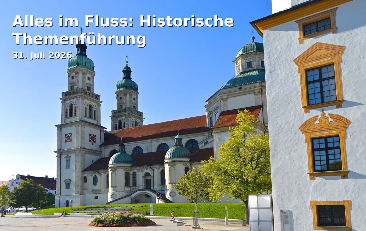
Location, Surroundings, and Special Features by the River
The Illersteg is located in a landscape and urban planning transition area that is exciting. To the west are the city center and historic structures, while to the east are river areas, residential neighborhoods, and the areas at Illerdamm. In regional descriptions, the surroundings are understood as part of a route through the Iller Valley, which touches not only the river but also the history of timber rafting, mills, industry, and urban development. This is precisely what makes the place special: Here, the modern infrastructure of a city center bridge meets a river area that has always played a defining role for Kempten. The bridge is therefore not only a traffic object but also a symbol of how the city grows together across the Iller. Those standing here experience not only a crossing but a clear spatial separation and at the same time a connection between two halves of the city. This is equally interesting for walkers, cyclists, and tourists because the location provides orientation and tells a story. For the search query Illersteg Kempten, this aspect is important because many people are not just looking for a point on the map but also the spatial context. ([allgaeu.de](https://www.allgaeu.de/buchen/oa/alles-im-fluss?utm_source=openai))
According to the planning documents, the new bridge should also integrate as unobtrusively as possible into the urban landscape and complement the existing bridge landscape with a standalone structure. This is an important point for everyone interested in the new construction: The bridge is to become functionally more modern without overshadowing the character of the river area. The documents also mention a connection that will be even better oriented towards pedestrian and bicycle traffic in the future and will be accompanied by landscaping on the Illerdamm side. This will create not only a technical new construction but also a designed transition between bank, path, and city. For visitors, this means: The Illersteg remains a landmark for everyday routes, walks, and bike tours along the Iller. For the city, it means that a heavily frequented place is being modernized without losing its quality of location. Thus, the bridge covers several search intentions: People search for the closure, for parking, for access, for the new construction, and for the role of the structure in the urban landscape. This is precisely why the Illersteg is so valuable in the SEO context. ([competitionline.com](https://www.competitionline.com/de/news/preisgruppe/163101?utm_source=openai))
Where can I find the Illersteg if I am walking or cycling?
The Illersteg can most easily be described as a connection between the city center and the area at Illerdamm. Those on foot can reach it from the old town and from the area around Pfeilergraben and Grabengasse towards Illerstraße and further to the bridge. Regional tours with city walks or river promenades mark this path as an important landmark. For cyclists, the location is also practical because the bridge is part of an east-west axis and makes the crossing between the riverbank and city center very direct. This explains why the bridge is used so routinely in daily life: It saves time, keeps routes short, and creates an immediate connection between the urban core and river zone. Since the bridge will be removed during the construction work, this self-evidence will be temporarily interrupted. Therefore, it makes sense to familiarize oneself with the location in advance and to know alternatives. The Illersteg will remain a fixed landmark on the map, but access will change significantly during the construction phase. ([allgaeu.de](https://www.allgaeu.de/touren/rundtour-von-kempten-durch-das-illertal?utm_source=openai))
FAQ about the Illersteg in Kempten
Many questions surrounding the Illersteg do not revolve around the bridge as a structure but around everyday life: How do I get across, where do I park my car, how long will the closure last, and why is it being rebuilt at all? The most important answers can already be derived from the current municipal documents. Since the Illersteg is a central pedestrian and bicycle axis, the changes affect many people simultaneously. This is precisely why it is worthwhile to summarize the facts concisely and reliably. So if you are searching for Illersteg Kempten closed, new construction, or parking, you will find the most important data already bundled here. ([ratsinfo.kempten.de](https://ratsinfo.kempten.de/bi/getfile.php?id=84822&type=do&utm_source=openai))
The bridge is being replaced because it is structurally deficient and its function as the main connection between the city center and Illerdamm should be preserved in the long term. The new construction is planned for 2026 to the end of 2027, with costs amounting to around 7.5 million euros. No temporary bridge is planned for the construction period; instead, the city is working on a bus shuttle and managing the parking space at Illerdamm. Those parking there utilize the area, which according to the city includes 379 parking spaces. And for those wanting to know how heavily the bridge is used, the figures from 2023 provide a clear picture: around 1.25 million crossings per year speak for themselves. ([ratsinfo.kempten.de](https://ratsinfo.kempten.de/bi/getfile.php?id=84822&type=do&utm_source=openai))
Sources:
- City of Kempten - Resolution Document Illersteg Replacement Construction ([ratsinfo.kempten.de](https://ratsinfo.kempten.de/buergerinfo/getfile.asp?id=87473&type=do&utm_source=openai))
- City of Kempten - Meeting Document Bus Shuttle at Illersteg ([ratsinfo.kempten.de](https://ratsinfo.kempten.de/bi/getfile.php?id=84822&type=do&utm_source=openai))
- Smart Kempten - Parking Space Monitoring at Illerdamm ([smartes.kempten.de](https://smartes.kempten.de/aktuelles-441.html?utm_source=openai))
- Allgäu - Hiking Tour Along the Iller ([allgaeu.de](https://www.allgaeu.de/touren/rundtour-von-kempten-durch-das-illertal?utm_source=openai))
- Allgäuer Zeitung - Illersteg in Kempten Closed for Twelve Months ([allgaeuer-zeitung.de](https://www.allgaeuer-zeitung.de/kempten/illersteg-in-kempten-fuer-zwoelf-monate-gesperrt-mitte-2026-soll-es-losgehen-112575449?utm_source=openai))
Mehr anzeigenWeniger anzeigen
Illersteg | New Construction & Closure
The Illersteg in Kempten (Allgäu) is much more than a simple crossing over the Iller. For many people, it is the direct connection between the city center, Illerdamm, the area near the Illerstadion, and the residential neighborhoods located east of the Iller. The city describes it as a main axis for pedestrian and bicycle traffic; at the same time, it provides access to the parking lots at Illerdamm and alleviates the route through the city center. This is precisely why the planned replacement construction is attracting so much attention: The structure has aged, the bridge is regularly inspected, and is now to be replaced by a new connection. For users, this means that the Illersteg remains a central topic for access, parking, closure, and detour in Kempten, shaping the daily journey into the city as well as excursions to the Iller. ([ratsinfo.kempten.de](https://ratsinfo.kempten.de/bi/getfile.php?id=84822&type=do&utm_source=openai))
Why the Illersteg is so important for Kempten
When analyzing search queries related to the Illersteg, a pattern becomes particularly clear: People want not only to find the name of the bridge but, above all, to understand how important this connection is in daily life. According to the city, the Illersteg connects the city center with 379 parking spaces at Illerdamm and with the residential area east of the Iller; it is also an important east-west axis for cyclists. The strong usage of this connection is also evidenced by the counting data from 2023: The bridge was crossed approximately 1.25 million times, of which 870,000 times on foot. These figures explain why the term Illersteg is not only searched as a place name in Kempten but is almost always associated with the topics of new construction, closure, parking, and detour. For the locals, it is a daily route, for visitors a practical shortcut, and for the city, a sensitive mobility hub. It is precisely at such points that most questions arise because any change becomes immediately noticeable. Those who walk or ride over the Illersteg save themselves the detour over other crossings and reach the center quickly. Therefore, a replacement construction does not affect some peripheral area but one of the most important pedestrian and bicycle connections in urban daily life. ([ratsinfo.kempten.de](https://ratsinfo.kempten.de/bi/getfile.php?id=84822&type=do&utm_source=openai))
From an urban planning perspective, the location is also interesting. The Illersteg is located in the area of Pfeilergraben and Illerdamm, at a point where the city center, river area, and traffic routes meet directly. Regional directions and tours highlight the bridge as a significant transition point, allowing access from the city center towards the Iller and eastern neighborhoods. The surrounding area is therefore not an interchangeable traffic point but a threshold between the historic city center, river zone, and the more everyday-oriented areas along the river. For seekers, this is important because they often want to understand not only the bridge itself but also its location within the urban structure. The Illersteg functions as a landmark: It indicates where the city center opens up to the east, where parking begins, and where the river becomes a visible spatial boundary. At the same time, it shows how closely Kempten is connected to the Iller. Those searching for the bridge often also look for the shortest walking path, the best access to the bank, or the connection between the old town and parking lot. This combination of city, river, and movement makes the location so searchable. ([allgaeu.de](https://www.allgaeu.de/buchen/oa/alles-im-fluss?utm_source=openai))
New Construction of the Illersteg: Timeline, Construction Method, and Costs
The current planning foresees a clear replacement construction. According to the city’s meeting documents, the tendering process is underway, with the awarding of contracts scheduled for July 2026, construction is expected to begin in the weeks following the festival week of 2026, and completion is planned for the end of 2027, including accompanying landscaping work. Financially, the project is also precisely quantified: The total project costs are around 7.5 million euros, of which about 5.2 million euros are to be funded by the Federal Republic of Germany, corresponding to a rate of 75 percent. For a pedestrian and bicycle bridge, this is a significant investment framework, but also a clear sign that the city wants to secure the connection not just temporarily but renew it in the long term. The new construction will therefore not be understood as a cosmetic measure but as a strategic infrastructure decision for daily traffic between the city center and Illerdamm. Especially for a bridge used by so many people in daily life, future viability plays a greater role than mere maintenance. Therefore, the new construction is simultaneously a traffic, urban development, and mobility project. For the search query Illersteg Kempten new construction, this information is crucial: When does it start, how long will it take, and what will it cost? The city answers these questions with a very concrete timeline. ([ratsinfo.kempten.de](https://ratsinfo.kempten.de/buergerinfo/getfile.asp?id=87565&type=do&utm_source=openai))
Particularly interesting is the constructive idea behind the new structure. The city describes the planned Illersteg as an innovative, segmental hybrid construction made of steel, wood, and carbon concrete. The advantage of this solution is that damaged components can be replaced in sections in the future without having to address the entire load-bearing structure at once. This is a significant point for later maintenance, as maintenance and repairs can be better planned. At the same time, the new bridge is to be complemented by landscaping work in the bank area on the Illerdamm side, so that not only the structure itself but also its surroundings are enhanced. From a planning perspective, this is relevant because the bridge must fit into a sensitive river and urban space structure. The city is therefore relying on a combination of function, modern technology, and design restraint. This is also where the SEO relevance lies: Those searching for the Illersteg are not only interested in a bridge closure but also in materials, construction methods, durability, and urban integration. Additionally, the city points out that engineering structures are regularly inspected according to DIN 1076; the replacement construction is therefore also the result of systematic structure management. ([ratsinfo.kempten.de](https://ratsinfo.kempten.de/buergerinfo/getfile.asp?id=87473&type=do&utm_source=openai))
Closure and Replacement During the Construction Period
The most important news for the construction phase is: No temporary bridge will be erected. The city justifies this with the disproportionately high costs for such a temporary solution. Instead, the pedestrian and bicycle connection will be completely discontinued during the construction period of just over a year. The municipal document explicitly points out that the situation will have negative impacts because the detour is about one kilometer. This may sound manageable on paper, but in everyday life, it is a real hurdle for many people. Those who are older, have difficulty walking, are pushing children, or want to cycle from the city center to Illerdamm and back will need to plan significantly more time. This also changes the routine use of urban space for commuters and recreational users who are accustomed to the short route. For this reason, the search term Illersteg Kempten closed is so important: People want to know not only that the bridge will be closed but, above all, what this means for their route. The closure is therefore not just a construction site announcement but a question of everyday life. ([ratsinfo.kempten.de](https://ratsinfo.kempten.de/bi/getfile.php?id=84822&type=do&utm_source=openai))
As a replacement, a bus shuttle is planned or has been specifically addressed in the municipal consultation. This is intended to relieve those for whom the additional walking distance is difficult to bear. At the same time, the current planning shows that the closure will affect all traffic in the surrounding area: Already during the construction work, the direct route from the parking lots at Illerdamm and Illerstadion to the city center will no longer be possible, which is why the city is monitoring the occupancy of parking spaces with cameras and evaluations. In another document, the bus shuttle is explicitly mentioned as a measure to facilitate the route from Illersteg-East over the St.-Mang-Bridge to Illerstraße. This shows that the city does not simply refer to a detour but wants to actively manage traffic flow. For users, this is an important point: Those who park in the future, want to walk into the city, or want to cross the river will need to expect new routes. In practice, this means that search queries regarding closure, access, and alternative routes will remain particularly relevant as long as the construction work is ongoing. ([smartes.kempten.de](https://smartes.kempten.de/aktuelles-441.html?utm_source=openai))
Parking at Illerdamm and Routes to the City Center
A central keyword in search queries is not directly parking, but it plays a significant role in practice. According to the city, the Illersteg is the main axis between the city center and 379 parking spaces at Illerdamm. It is clear: Those who park their car here usually want to get to the city center or back in the shortest way. The area at Illerdamm is therefore not just any peripheral area but a deliberately integrated parking system of the city. However, during the construction period, this short route will be interrupted, which may increase parking search traffic and pressure on other parking spaces. The city assumes that the diversion movements will impact the surrounding parking areas and has therefore begun to collect the situation in more detail. For visitors, this means practically: Those who want to park at Illerdamm should plan more time, check the city’s notices, and consider how the further route into the city center will look. The search term Illersteg Kempten parking is therefore not secondary but directly connected to the traffic effects of the bridge. ([ratsinfo.kempten.de](https://ratsinfo.kempten.de/bi/getfile.php?id=84822&type=do&utm_source=openai))
It is also practically relevant that the city’s long-term parking regulation explicitly names Illerdamm as a paid long-term parking area. This shows how firmly the area is integrated into the inner-city parking system. At the same time, the city is working on parking space monitoring at Illerdamm to better manage occupancy during the construction phase and avoid overloading other parking spaces. For access on foot or by bike, the Illersteg is normally located via Pfeilergraben, Illerdamm, and Illerstraße; regional tour descriptions lead from the city center via Grabengasse and Illerstraße towards the bridge. This is helpful for guests as it facilitates orientation, and for locals, it is taken for granted as the route is often used out of habit. However, once the bridge is closed, this self-evidence becomes a planning-relevant question. Therefore, those searching for directions to Illersteg Kempten need not only a map position but also an understanding of how parking, walking routes, and detours are interconnected. This combination makes the location so important for local search queries. ([formulare.kempten.de](https://formulare.kempten.de/frontend-server/form/provide/804/?utm_source=openai))
Location, Surroundings, and Special Features by the River
The Illersteg is located in a landscape and urban planning transition area that is exciting. To the west are the city center and historic structures, while to the east are river areas, residential neighborhoods, and the areas at Illerdamm. In regional descriptions, the surroundings are understood as part of a route through the Iller Valley, which touches not only the river but also the history of timber rafting, mills, industry, and urban development. This is precisely what makes the place special: Here, the modern infrastructure of a city center bridge meets a river area that has always played a defining role for Kempten. The bridge is therefore not only a traffic object but also a symbol of how the city grows together across the Iller. Those standing here experience not only a crossing but a clear spatial separation and at the same time a connection between two halves of the city. This is equally interesting for walkers, cyclists, and tourists because the location provides orientation and tells a story. For the search query Illersteg Kempten, this aspect is important because many people are not just looking for a point on the map but also the spatial context. ([allgaeu.de](https://www.allgaeu.de/buchen/oa/alles-im-fluss?utm_source=openai))
According to the planning documents, the new bridge should also integrate as unobtrusively as possible into the urban landscape and complement the existing bridge landscape with a standalone structure. This is an important point for everyone interested in the new construction: The bridge is to become functionally more modern without overshadowing the character of the river area. The documents also mention a connection that will be even better oriented towards pedestrian and bicycle traffic in the future and will be accompanied by landscaping on the Illerdamm side. This will create not only a technical new construction but also a designed transition between bank, path, and city. For visitors, this means: The Illersteg remains a landmark for everyday routes, walks, and bike tours along the Iller. For the city, it means that a heavily frequented place is being modernized without losing its quality of location. Thus, the bridge covers several search intentions: People search for the closure, for parking, for access, for the new construction, and for the role of the structure in the urban landscape. This is precisely why the Illersteg is so valuable in the SEO context. ([competitionline.com](https://www.competitionline.com/de/news/preisgruppe/163101?utm_source=openai))
Where can I find the Illersteg if I am walking or cycling?
The Illersteg can most easily be described as a connection between the city center and the area at Illerdamm. Those on foot can reach it from the old town and from the area around Pfeilergraben and Grabengasse towards Illerstraße and further to the bridge. Regional tours with city walks or river promenades mark this path as an important landmark. For cyclists, the location is also practical because the bridge is part of an east-west axis and makes the crossing between the riverbank and city center very direct. This explains why the bridge is used so routinely in daily life: It saves time, keeps routes short, and creates an immediate connection between the urban core and river zone. Since the bridge will be removed during the construction work, this self-evidence will be temporarily interrupted. Therefore, it makes sense to familiarize oneself with the location in advance and to know alternatives. The Illersteg will remain a fixed landmark on the map, but access will change significantly during the construction phase. ([allgaeu.de](https://www.allgaeu.de/touren/rundtour-von-kempten-durch-das-illertal?utm_source=openai))
FAQ about the Illersteg in Kempten
Many questions surrounding the Illersteg do not revolve around the bridge as a structure but around everyday life: How do I get across, where do I park my car, how long will the closure last, and why is it being rebuilt at all? The most important answers can already be derived from the current municipal documents. Since the Illersteg is a central pedestrian and bicycle axis, the changes affect many people simultaneously. This is precisely why it is worthwhile to summarize the facts concisely and reliably. So if you are searching for Illersteg Kempten closed, new construction, or parking, you will find the most important data already bundled here. ([ratsinfo.kempten.de](https://ratsinfo.kempten.de/bi/getfile.php?id=84822&type=do&utm_source=openai))
The bridge is being replaced because it is structurally deficient and its function as the main connection between the city center and Illerdamm should be preserved in the long term. The new construction is planned for 2026 to the end of 2027, with costs amounting to around 7.5 million euros. No temporary bridge is planned for the construction period; instead, the city is working on a bus shuttle and managing the parking space at Illerdamm. Those parking there utilize the area, which according to the city includes 379 parking spaces. And for those wanting to know how heavily the bridge is used, the figures from 2023 provide a clear picture: around 1.25 million crossings per year speak for themselves. ([ratsinfo.kempten.de](https://ratsinfo.kempten.de/bi/getfile.php?id=84822&type=do&utm_source=openai))
Sources:
- City of Kempten - Resolution Document Illersteg Replacement Construction ([ratsinfo.kempten.de](https://ratsinfo.kempten.de/buergerinfo/getfile.asp?id=87473&type=do&utm_source=openai))
- City of Kempten - Meeting Document Bus Shuttle at Illersteg ([ratsinfo.kempten.de](https://ratsinfo.kempten.de/bi/getfile.php?id=84822&type=do&utm_source=openai))
- Smart Kempten - Parking Space Monitoring at Illerdamm ([smartes.kempten.de](https://smartes.kempten.de/aktuelles-441.html?utm_source=openai))
- Allgäu - Hiking Tour Along the Iller ([allgaeu.de](https://www.allgaeu.de/touren/rundtour-von-kempten-durch-das-illertal?utm_source=openai))
- Allgäuer Zeitung - Illersteg in Kempten Closed for Twelve Months ([allgaeuer-zeitung.de](https://www.allgaeuer-zeitung.de/kempten/illersteg-in-kempten-fuer-zwoelf-monate-gesperrt-mitte-2026-soll-es-losgehen-112575449?utm_source=openai))
Frequently Asked Questions
Reviews
Acksah Mathew
21. July 2024
Beautiful place 🏞️✨
Johnny F.
24. April 2024
The bridge connects the urban area with a fairly large park and a recreational area, as well as the Illerstadion. The bridge is accessible for both pedestrians and cyclists. Cyclists are counted electronically when crossing.
Mike Borgs
28. February 2025
Nice bridge over the Iller. You can reach the pedestrian zone from the camper parking area in 5 minutes.
Dr.Elke Heck
11. September 2024
Nice path to the Illersteg - beautiful viewpoint - very popular when the weather is good!
Matthias Meier
2. November 2023
There's always something happening at the Illersteg, and cyclists are counted electronically each day.